Satellites
Another source that meteorologist use to collect data to predict weather are satellites.
Satellite images are used for seeing cloud patterns and movements.
For example, hurricane clouds and movement can be observed using satellite images.
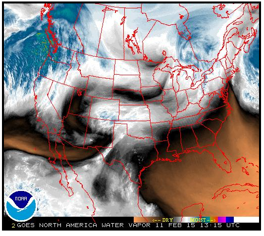
Below is an example of a satellite image that show water vapor. Where do you think precipitation is occurring?
Satellite images are used for seeing cloud patterns and movements.
For example, hurricane clouds and movement can be observed using satellite images.
Below is an example of a satellite image that show water vapor. Where do you think precipitation is occurring?
Satellite Images
Click on the link to see up-to-date satellite images from National Weather Service. http://www.weather.gov/satellite
|
|

|